Skip to Content
Streetsblog Los Angeles home
Log In
Measure M

A Visual Representation of L.A.’s Rail Growth Under Measure M

Los Angeles MetroRail - Comparrison

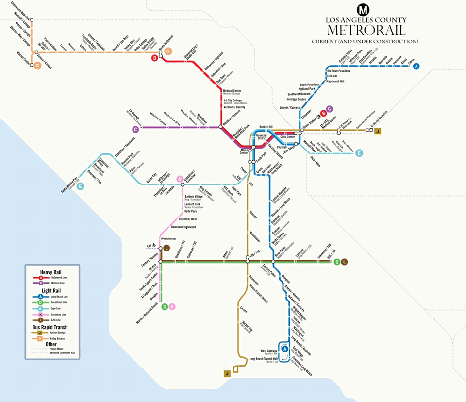
We're working on a couple of larger stories for later in the week, but in the meantime we thought readers would appreciate this map by Adam Linder.

Linder's map shows how Metro Rail and Metro Rapid Bus will grow in the coming years from where it is now (including lines under construction) to where it would be, assuming a Measure M build-out.

The Southern California Streets Initiative has not taken a position on Measure M. SCSI publishes not just the three California-based Streetsblogs, but also LongBeachize and Santa Monica Next.

If you like Adam's map feel free to drop him a line at Infinite3Ent@gmail.com or find him on Instagram at adamglinder.

Stay in touch

Sign up for our free newsletter

More from Streetsblog Los Angeles

Caltrans Posts Draft Master Plan for PCH in Malibu

Activists agree this plan is a huge improvement over current conditions, but there are some areas where it could be even better.

April 16, 2025

New Bike Lanes on Mission Road and Bonnie Brae Street

New bike lanes are complete on Westlake's Bonnie Brae Street. New partially-protected bike lanes are being installed on Mission Road in Boyle Heights.

April 15, 2025
See all posts